


Voting District 9007, Spokane County, Washington
About
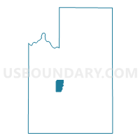
Outline

Summary
| Unique Area Identifier | 689503 |
| Name | Voting District 9007 |
| County | Spokane County |
| State | Washington |
| Area (square miles) | 13.96 |
| Land Area (square miles) | 13.96 |
| Water Area (square miles) | 0.00 |
| % of Land Area | 100.00 |
| % of Water Area | 0.00 |
| Latitude of the Internal Point | 47.56000640 |
| Longtitude of the Internal Point | -117.53380460 |
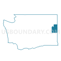
Maps

Graphs
Select a template below for downloading or customizing gragh for Voting District 9007, Spokane County, Washington


Neighbors
Neighoring Voting District (by Name) Neighboring Voting District on the Map
- Voting District 6022, Spokane County, WA
- Voting District 9004, Spokane County, WA
- Voting District 9006, Spokane County, WA
- Voting District 9008, Spokane County, WA
- Voting District 9010, Spokane County, WA
Top 10 Neighboring County Subdivision (by Population) Neighboring County Subdivision on the Map
- Spokane CCD, Spokane County, WA (353,581)
- Cheney-Medical Lake CCD, Spokane County, WA (24,273)
- Spokane South CCD, Spokane County, WA (7,653)
Top 10 Neighboring Unified School District (by Population) Neighboring Unified School District on the Map
Top 10 Neighboring State Legislative District Lower Chamber (by Population) Neighboring State Legislative District Lower Chamber on the Map
Top 10 Neighboring State Legislative District Upper Chamber (by Population) Neighboring State Legislative District Upper Chamber on the Map
Top 10 Neighboring 111th Congressional District (by Population) Neighboring 111th Congressional District on the Map
Top 10 Neighboring Census Tract (by Population) Neighboring Census Tract on the Map
- Census Tract 135, Spokane County, WA (7,653)
- Census Tract 141, Spokane County, WA (5,507)
- Census Tract 136, Spokane County, WA (4,101)